Petrobras Strikes Amazon Crude, and a Reef Nobody Fully Understands Braces for Impact
eyesonbrasil
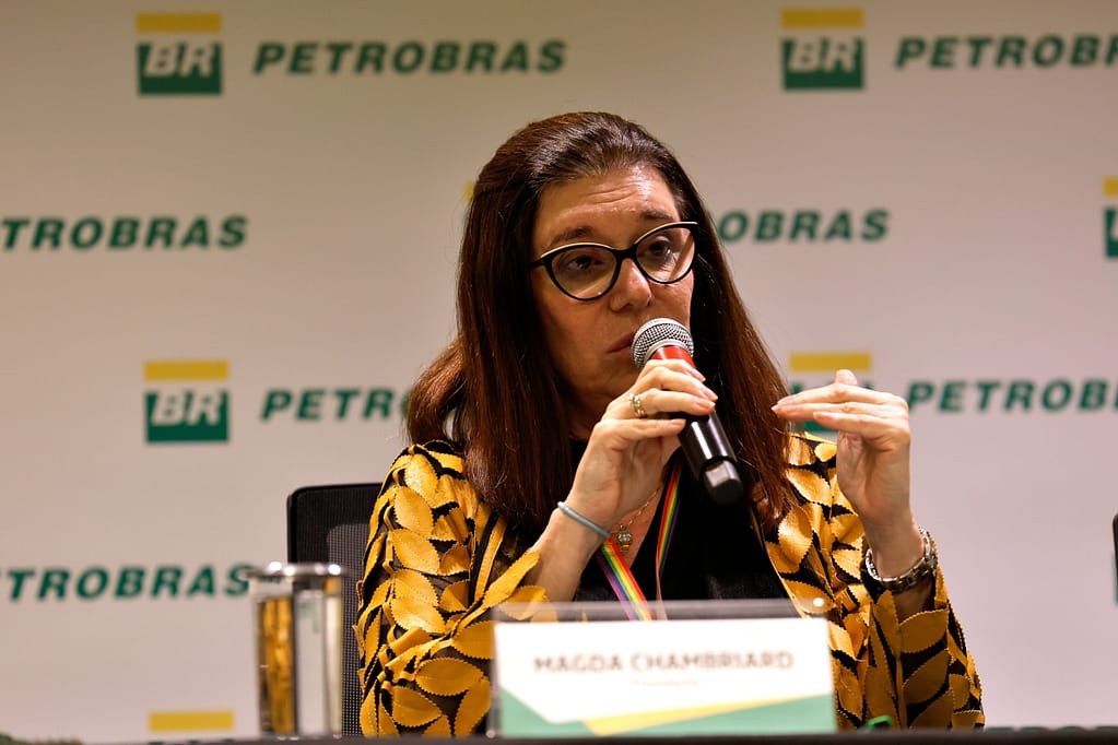
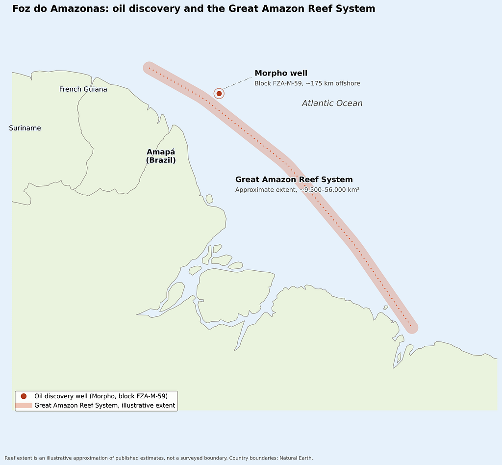
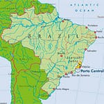
On the afternoon of August 14, 2026, Petrobras told the world what it had spent thirteen years and hundreds of millions of dollars chasing: there is oil at the bottom of the Amazon River’s mouth. Electric logs and rock samples pulled from the Morpho well, drilled through 2,886 meters of ultra-deep water roughly 175 kilometers off the coast of Amapá, showed clear signs of hydrocarbons. Petrobras CEO Magda Chambriard called it confirmation of the company’s long-held optimism about Brazil’s so-called Equatorial Margin — “the result of the dedication and competence of Petrobras, which is committed to rebuilding the country’s oil reserves and to energy security.”
Petrobras CEO Magda Chambriard
It is, by any measure, a milestone. It is also the moment the country’s oldest environmental fight over this stretch of ocean stops being hypothetical.
A discovery thirteen years in the making
The find sits inside block FZA-M-59, which Petrobras has held exclusively since a 2013 auction. Getting permission to actually drill it took most of the years since. Brazil’s environmental agency, IBAMA, rejected the company’s first license application in 2023, citing unresolved risks to a region its own technical staff considered too ecologically fragile and too poorly served by emergency infrastructure to safely absorb an oil operation. Petrobras appealed, ran a mandated emergency-response drill in August 2025 that mobilized more than 400 personnel, and — under sustained political pressure, including public appeals from President Lula himself — finally won its license in October 2025.
The company didn’t get a clean start. In January 2026, drilling at the site had to be paused after Petrobras confirmed a leak of synthetic drilling fluid; IBAMA fined the company 2.5 million reais (about $485,000) the following month. Five months later, the well that had already leaked once produced the discovery Petrobras is now celebrating.
That sequence — license denied, license granted under pressure, spill, then strike — is exactly the pattern scientists and environmental groups spent a decade warning about.
The reef the drilling license almost forgot
Less than 40 kilometers from the Morpho well sits one of the strangest ecosystems marine science has documented this century: the Great Amazon Reef System.
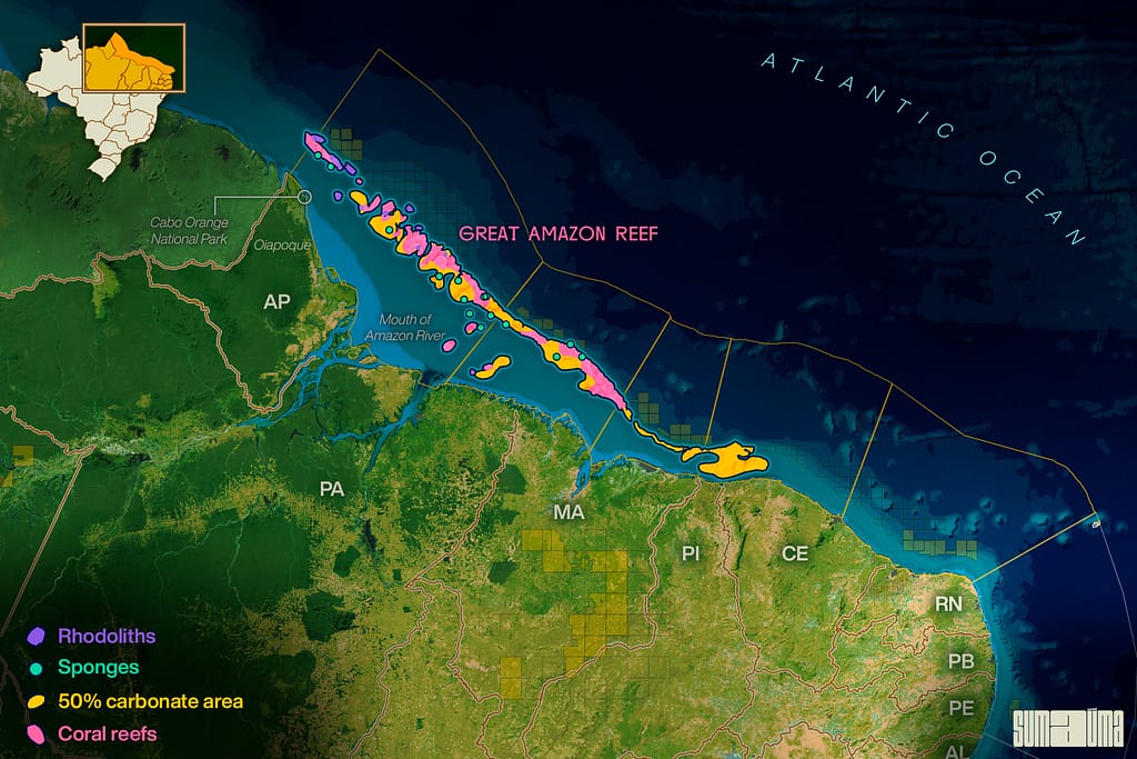
Great Amazon Reef System
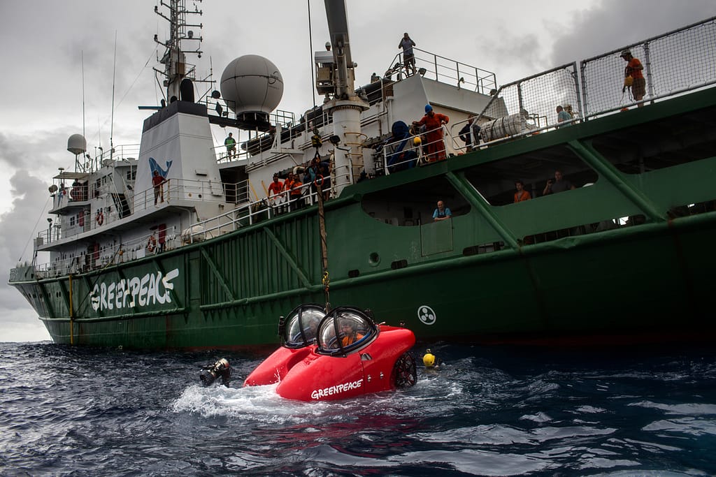
It shouldn’t exist. Coral reefs are supposed to need clear, sunlit water — the opposite of what pours out of the mouth of the world’s largest river, a plume of sediment-choked freshwater that turns the surrounding ocean brown for hundreds of kilometers. Yet when a team of Brazilian researchers led by Rodrigo de Moura and Ronaldo Francini-Filho formally described the system in a 2016 paper, they found something nobody had modeled for: a vast, low-light reef running along the edge of the continental shelf, built not on sunlight-dependent coral alone but on sponges, rhodoliths, calcareous algae, starfish, and colonies of coral that had adapted to conditions no reef was thought to tolerate. A Greenpeace expedition the following year sent a submarine down to film it, producing some of the first images the public had ever seen of a reef most scientists hadn’t known was there. Later surveys, published with Greenpeace’s backing, suggested the system might sprawl across as much as 56,000 square kilometers — six times the original estimate — stretching roughly 1,000 kilometers along Brazil’s northern coast and functioning as a living bridge between the reef ecosystems of Brazil and the Caribbean.
One of the first images of the Amazon Reef taken from a submarine launched from the MY Esperanza. The Greenpeace ship is currently in the region of the Amazon river mouth, Amapá State, for the “Defend the Amazon Reef” campaign.
Francini-Filho has been blunt about what that means for licensing decisions taken in the years since: the reef’s connection to the Amazon River and forest is direct enough, and its role in regional biodiversity and climate regulation significant enough, that he has called for a network of marine protected areas built around the precautionary principle — the idea that when you don’t yet know how much damage is possible, you don’t take the risk to find out.
Francini-Filho
Brazil’s government took a different path. IBAMA’s own technical staff, at multiple points, recommended against granting Petrobras a license, warning that a spill in the region could cause damage that couldn’t be undone before scientists had even finished cataloguing what was there to lose. Those recommendations were repeatedly overridden further up the chain.
Why a spill here would be unlike a spill anywhere else
The Equatorial Margin isn’t the Campos Basin or Rio’s coastline, where Petrobras has operated for decades and built the infrastructure to match. Marcelo Martinelli Filho, an environmental-impact specialist who has studied the region, put it plainly: the logistics and risk-management systems that exist in Brazil’s south have taken decades to build, and off the Amazonian coast they remain, in his words, incipient. A former IBAMA president has said that gap in emergency capacity was central to the agency’s earlier decisions to deny Petrobras a license altogether.
The physical conditions compound the problem. Currents at the mouth of the Amazon are unusually complex, and tides can swing by as much as nine meters between high and low water — a combination that makes containing a spill dramatically harder than in calmer, better-mapped waters. Researcher Philip Fearnside of Brazil’s National Institute for Amazonian Research has warned that a major leak here wouldn’t stay in Brazilian waters: current modeling suggests oil could travel far enough to reach French Guiana, Trinidad and Tobago, and other Caribbean states — turning a single accident into a problem for as many as eight countries.
On Friday, January 27, the submarine was launched from the ship Esperanza with Ronaldo Francini Filho, a scientist from the Federal University of Paraíba, and John Hocevar, director of the Greenpeace U.S. Oceans Campaign. Ronaldo is part of the group of scientists who discovered the coral reef at the mouth of the Amazon River. The submarine’s launch involved a large portion of the ship’s crew.
Environmental groups that sued to block the project have also challenged the science Petrobras used to get licensed in the first place. Attorneys involved in the case argue that Petrobras’s spill-behavior modeling relied on outdated and incomplete data, and that IBAMA approved the license anyway. Their own technical analysis estimated that roughly 20 percent of spilled oil in a real accident would sink into the water column rather than stay on the surface — precisely the kind of underwater, out-of-sight contamination that is hardest to detect, track, and clean, and most likely to settle directly onto reef structures and the sponge and coral gardens that took centuries to grow.
Then there’s what a spill would do beyond the reef itself. The Amazonian coast holds the world’s second-largest belt of mangrove forest, a nursery for hundreds of species of fish and marine life. Oceanographer Thomás Banha, who studies the Amazon reef, has called mangroves the single hardest ecosystem to clean once oil reaches them — their tangled root systems trap contamination in ways open water and sandy coastline don’t. Local fishing communities, who depend on these waters more heavily than counterparts almost anywhere else in Brazil, would absorb both the ecological and the economic cost first and worst.
The defense, and the doubt
Petrobras’s public position has been that the drilling zone is safely separated from anything worth protecting. At earlier stages of licensing, the company stated there was no record of conservation units, rivers, lakes, floodplains, or reef systems near its blocks. Scientists studying the region have directly disputed that characterization, noting the Amazon Reef sits well within the distance a spill’s currents could realistically reach — a discrepancy that has become one of the sharper points of conflict between the company’s official environmental filings and the field data independent researchers have gathered.
Petrobras has also framed the broader project as compatible with Brazil’s climate commitments, arguing that revenue from new offshore oil helps fund the country’s transition to renewable energy. Suely Araújo, a former IBAMA president now with the Climate Observatory — one of the organizations behind the legal challenge to the project — rejects that logic on its own terms. Most of Brazil’s oil, she notes, doesn’t go to meet domestic energy needs; more than half is already exported. The Foz do Amazonas expansion, in her assessment, is revenue-driven, not transition-driven — and the transition argument, she says, only holds up in oil regions that are already developed, not ones environmental agencies have repeatedly flagged as too fragile to open.
What comes next
Petrobras has been explicit that Friday’s announcement is only the first stage of a longer process: the company now has to run further studies to size the reservoir and determine whether extraction is commercially viable at all. That leaves a window — likely years — before Foz do Amazonas oil could actually reach a tanker.
It also leaves the reef exactly where it’s been for the better part of a decade: caught between a state oil company racing to replace reserves before its pre-salt fields peak around 2030, and a scientific community that still doesn’t have a complete map of what it’s trying to protect. More than 20 additional oil blocks along this same coastline have already been auctioned for future exploration. Environmental advocates warn that unless Foz do Amazonas activity is stopped or substantially constrained now, this well is not the endpoint of drilling on Brazil’s Amazon coast — it’s the opening one.
Brazil found oil at the edge of the Amazon on the same year it hosted the world’s climate summit in the Amazon rainforest itself. Whether that coincidence becomes an irony or a turning point depends on decisions that, as of this week, are still being made in real time.